
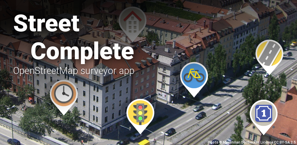
For those, who don’t know: There is an app called StreetComplete.
StreetComplete is a mobile app that enhances OpenStreetMap (OSM) by allowing users to contribute to mapping efforts in their local areas. It gamifies the process of collecting and verifying geographic data through simple tasks.
Such simple tasks in StreetComplete could be providing information regarding:
-
Classifying streets (one-way or not)?
-
Is an object (e.g. a bench or a trash bin) still there, or was it removed by the city/state?
-
When does shop XY open and close?
-
Who is allowed to use the parking lot?
-
Does a bus station have lights?
-
Can people with disabilities use the crosswalk?
-
Is a way for bicycles?
It’s getting warmer outside. Why not going out and playing it bit? It might feel a little bit like Pokemon GO (but compared to it, your location data won’t be sold to Saudi Arabia).
If you usually don’t go outside often or walk around outside often, maybe this could be a motivation/reason…
Official website of StreetComplete with download links: https://streetcomplete.app/
FAQ: https://wiki.openstreetmap.org/wiki/StreetComplete/FAQ
If you have already use/played it, what’s your rank?
F-Droid says this has “anti-features”:
What is that about and is it ok? Would my collected data be going to a non-free enterprise? How exactly is the data used, does it go back to openstreetmaps?
@pr06lefs
Their privacy policy is here:
https://streetcomplete.app/privacy
It also looks to the tile providers privacy policy.
Only F-Droid would take the stated purpose of an app and warn you about it as an anti-feature, but here we are.
@lemmydividebyzero @openstreetmap
@pr06lefs @lemmydividebyzero you should really only use @fdroidorg if you buy in to their philosophy that everybody is out there is trying to get you.
Essentially if you have a web service and write an app for it, or you write/use a web service that supports the functionality of the app that can’t be simply replaced (because it is app specific) they will immediately “anti-feature” you. Its a shame because it makes it difficult to find the real issues in all the noise they produce.
The only really non-free thing is Jawg.io, which does not take your data and only renders OSM’s map data into maps. The westnordost.de (developer’s website) photo service is open source at https://github.com/streetcomplete/sc-photo-service and the only other thing westnordost.de is used for is an email server to receive bug reports and (as mentioned in the app’s “privacy” page) is checking against https://www.westnordost.de/streetcomplete/banned_versions.txt, which is technically non-free I guess? but that’s just a list of versions.
Wouldn’t it be a good idea to eventually find a FOSS/open replacement for the Jawg thing?
WestNordOst seems to be the user name of the main developer.
I can give you one example. If you go to a bench and answer the question “Is it still there” with “yes”, the bench object tracked by OpenStreetMaps will get a tag that is similar to “last-checked-for-existance: 03/16/2025”. If you answer “no”, it might get removed from the OSM database. So, yes, it results in changes in the OpenStreetMap database.
Not sure, what that means, sorry.
I have also linked the FAQ (which are by the way hosted by OpenStreetMap) ->https://wiki.openstreetmap.org/wiki/StreetComplete/FAQ#How_does_the_app_handle_uploads?
Your changes get uploaded to openstreetmap.
Why does it say “non-free” then?
TL:DR: Jawg.io to render the map. Takes no information from you.
Its gonna know what tiles you’re downloading and thereby your approximate location.
That’s just slightly more precise than IP geolocation. As long as you use a cellphone with internet, your “approximate” location is out there somewhere unless you use Tor or something.
Out there somewhere, but not at jawg.io unless you’re using Street Complete. I mean I’ve heard worse and its probably no big deal, but best to be transparent about it so users can make an informed decision.
Contrast with OSMAND, where I downloaded my entire state and I can use the app without internet access at all.
Lol no. My IP geolocation is only 20% of the time the same continent as me. People use tools to protect that
Exactly, like Tor. Anonymizing your connection is not going to identify the downloaded locations to anyone in particular.
deleted by creator